
Samsuryeong
- ADDRESS 135, Jeokgak-dong, Taebaek-si
- CONTACT 033-550-2131
- HOLIDAY All-Year-round
- USE TIME All-Year-round
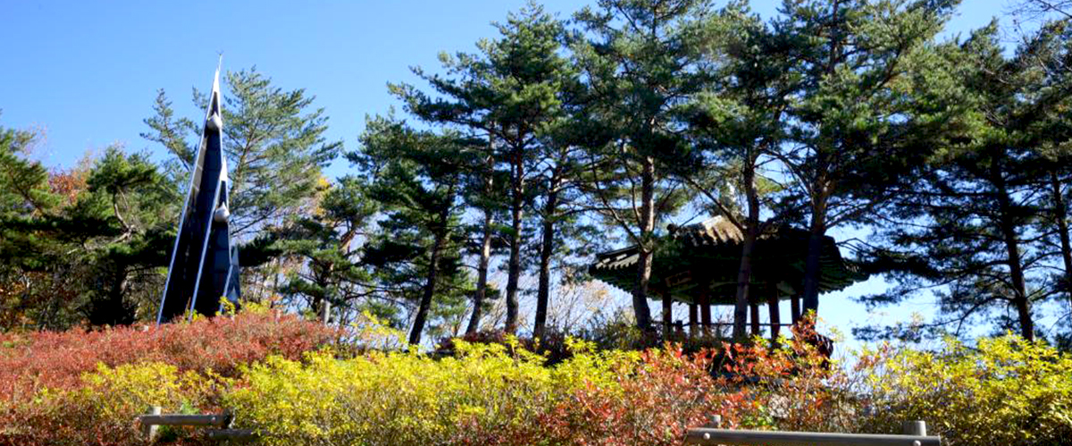
If you drive toward Samcheok on National Road ¢à 35 from downtown of Taebaek-si, you will come to a ridge rising 920 meters above sea level.
This is the watershed where the Hangang, the Nakdonggang and the Osip Stream diverge. Water which falls here as rain flows to the West Sea via the Hangang,
to the South Sea via the Nakdong, and to the East Sea via Samsuryeong. On its summit, there is a monument and a pavilion.
Samsuryeong has also been called Pijae, meaning a ridge where people sought refuge, a reference to a time when the people of Samcheok fled here to escape a war.
Mountain Climbing Course
SamsuryeongBunsuryeong RanchCheonuibong (2.1 km, takes 30 hours)
Tourist Sites in the Vicinity
| Geomnyongso | Gumdaebong | Yongyeon Cave |
| Mt. Maebong |
Information
Tourism Advertising: 550-2085
Tourist Information Center: 550-2828 / 552-8363
Tourist Information Center: 550-2828 / 552-8363